
- Boat Insurance
- Boat Browser
- Boating Courses
- Boat Registration
- Boating License
-
Boating Safety
Equipment
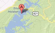
| South Holston Lake South Holston Lake's 7,580 acres are ideal for boating, kayaking, canoeing, water skiing, and fishing. Created by the Tennessee Valley Authority in the 1940s, the dam impounds the South Fork Holston River in Sullivan County, Tennessee. It is the first dam on the South Fork Holston, and it extends across Tennessee and Virginia state lines near Bristol. Located about 50 miles above the South Fork Holston River's confluence with the North Fork Holston River, the dam and lake are situated in a beautiful Appalachian Mountain setting. The dam site and the Tennessee portion of this reservoir are surrounded by the Cherokee National Forest, which extends up into Virginia. Fishing In 2010, a reciprocal agreement between Tennessee and the Virginia Department of Game and Inland Fisheries went into effect. Tennessee residents currently can purchase an annual South Holston Reservoir License to fish the Virginia side of the lake. Virginia residents can obtain a similar license to fish the Tennessee side, but all residents still must have a valid state license. This is important information, especially for trout fishing, as each resident must have a valid state license to fish for that species. Visiting anglers must abide by state boundaries and the state that issues the license. |
Search South Holston Lake Resources |
 Coordinates:
| Boating In Virginia, boaters can launch at Washington County Park near the Tennessee State line and at the Sportsman's Marina. Public access is available at the Avens ramp at the mouth of Fifteen Mile Creek and at Whitaker Hollow Park. |
|
Lodging Lodging on the Virginia side of South Holston Lake includes commercial camping and camping in the Virginia portion of Cherokee National Forest. For hotels, inns, and B&Bs, visitors can find rooms in Bristol and Abingdon. Review the Lake Resource Guide for additional lodging. Communities South Holston Lake is situated in Sullivan County, Tennessee, and in Washington County, Virginia. Nearby cities include Bristol (which straddles the Tennessee-Virginia state line) and Abingdon in Virginia, both located along I-81. Roanoke is located about two hours from the southern portion of the lake in Virginia via I-81 and Hwy 75 at Abingdon. Bristol is located just 11.6 miles (about 25 minutes) from the lake and Abingdon is located about 12 miles from the northern shores of the lake. |
Fun times at South Holston Lake
|


| Average Temperatures | Jan | Feb | Mar | Apr | May | Jun | Jul | Aug | Sep | Oct | Nov | Dec |
|---|---|---|---|---|---|---|---|---|---|---|---|---|
| Avg. High 45 | Avg. High 50 | Avg. High 59 | Avg. High 68 | Avg. High 76 | Avg. High 83 | Avg. High 86 | Avg. High 85 | Avg. High 79 | Avg. High 69 | Avg. High 59 | Avg. High 48 | |
| Avg. Low 25 | Avg. Low 28 | Avg. Low 34 | Avg. Low 42 | Avg. Low 51 | Avg. Low 60 | Avg. Low 64 | Avg. Low 63 | Avg. Low 55 | Avg. Low 44 | Avg. Low 35 | Avg. Low 28 |