
- Boat Insurance
- Boat Browser
- Boating Courses
- Boat Registration
- Boating License
-
Boating Safety
Equipment
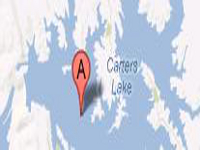
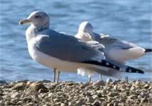
| Carters Lake Carters Lake, a U.S. Army Corps of Engineers project, is a reservoir that provides visitors with spectacular scenery, great boating, and well-stocked fishing opportunities. One of Georgia's deepest lakes at over 450 feet, this lake's shorelines lack private docks and developments that you might find at other area lakes. Located in both Gilmer and Murray Counties, Carters Lake is fed by the Coosawattee River and visitors use this lake and its gorgeous surroundings for boating, fishing, water skiing, hiking, camping, and mountain biking. Several campgrounds on the 62-mile shoreline offer camping, boat ramps, and other amenities. Located in north Georgia near the Chattahoochee National Forest, this lake offers great outdoor recreation for the entire family. Fishing Carters Lake experiences an active Georgia Department of Natural Resources stocking program that expands the regular menu of native fish at this lake. Species include a wide variety of bass, crappie, walleye, bream, and catfish. Numerous fish attractors dot the shores along this lake, making for an attractive and varied fishing experience, no matter your fishing preferences. |
Search Carters Lake Resources |
 Coordinates:
| Boating Carters Lake has seven boat ramps located at the dam site, including Doll Mountain, Woodring Branch, Ridgeway, and near the powerhouse off old Highway 411. All boat ramps outside a developed campground charge a day use fee. One marina is located at the lake to provide boaters and anglers with any equipment and supplies they might need, including boat and cabin rentals. |
|
|
Lodging Both Woodring Branch Campground and Doll Mountain Campground provide ways to spend time close to the lake. Both campgrounds are open until late October, but primitive camping is available year-round at Ridgeway, Woodring Branch, and at other boat-in campsites along the shoreline. For hotels, B&Bs, or cabins, you can visit Ellijay in Gilmer County, or Chatsworth in Murray County to enjoy local shops, restaurants, and attractions. The closest state park is Fort Mountain State Park, located near the Cohutta Wilderness. That park, which maintains cottages and tent and RV camp sites, is located 25 miles north of the lake near Chatsworth. Review the Lake Resource Guide for additional lodging. Communities Carters Lake is located in Murray and Gilmer Counties in Georgia, and the two most accessible towns include Ellijay and Chatsworth. Ellijay is located to the east at the boundary of the Rich Mountain Wilderness in the Chattahoochee National Forest. Chatsworth is located north along Highway 411 near Fort Mountain State Park. Located between Chattanooga, TN, and Atlanta, GA, to the east of I-75, this lake is easily accessible. |
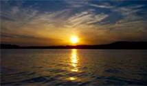
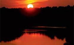
Fun times at Carters Lake
|
| Average Temperatures | Jan | Feb | Mar | Apr | May | Jun | Jul | Aug | Sep | Oct | Nov | Dec |
|---|---|---|---|---|---|---|---|---|---|---|---|---|
| Avg. High 48 | Avg. High 52 | Avg. High 61 | Avg. High 69 | Avg. High 76 | Avg. High 83 | Avg. High 86 | Avg. High 85 | Avg. High 79 | Avg. High 70 | Avg. High 60 | Avg. High 50 | |
| Avg. Low 30 | Avg. Low 34 | Avg. Low 40 | Avg. Low 47 | Avg. Low 55 | Avg. Low 63 | Avg. Low 67 | Avg. Low 66 | Avg. Low 60 | Avg. Low 49 | Avg. Low 41 | Avg. Low 34 |