
- Boat Insurance
- Boat Browser
- Boating Courses
- Boat Registration
- Boating License
-
Boating Safety
Equipment
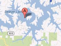
| Beaver Lake Beaver Lake is a reservoir that was formed when the U.S. Army Corps of Engineers completed the Beaver Dam across the White River in 1966. The Corps has since created a variety of recreational facilities around the lake with modern camp sites, hiking trails, boat ramps, and dump stations. Located about nine miles northwest of Eureka Springs, Arkansas, this lake sees approximately 3.1 million visitors annually. The White River begins in the Ozark-St. Francis National Forest, located southeast of Fayetteville, and flows into Beaver Lake. This lake is the first of several flood control lakes on the White River. The water from this reservoir flows northeast through Branson, Missouri into Lake Taneycomo, then to Table Rock Lake and Bull Shoals Reservoir, where it again crosses the state lines back into Arkansas. Fishing State records include a five-pound, four-ounce hybrid bass in 2003, and a 64-pound, eight-ounce striped bass in 2000 that Jeff Fletcher pulled from the Beaver tailwaters of the White River. According to the state, one hot spot includes the confluence of the White River and War Eagle Creek in the upper portion of Beaver Lake. For creek mouths, try War Eagle Creek, Ford's Creek, Cedar Creek, and Rambo Creek. |
Search Beaver Lake Resources |
 Coordinates:
| Boating At least seven full-service commercial marinas provide boaters and anglers with supplies and rentals. Boaters can find over 1,750 rental slips, and at least 28 boat ramps licensed to the county or to the State of Arkansas. The Corps maintains fourteen boat ramps at recreation areas located all along the lake. |
|
Lodging The Corps operates sixteen recreation areas, and eleven of these sites contain campgrounds. All campgrounds have electricity, and some are pull-through sites with dump stations. Lost Bridge North offers the most amenities. Also, Hobbs State Park-Conservation Area, which covers over 12,000 cares, is the largest state park in Arkansas, and it is located on the south shores of Beaver Lake. This park has primitive camp sites. Since this lake is located so close to many tourist attractions in the Ozark Mountains and a large urban area to the west, the accommodations are plentiful from Fayetteville north along I-540. Eureka Springs alone has over 2,500 available rooms in a quaint historic setting. Visitors also can find many short-term vacation rentals, lodges, and hotels around Beaver Lake.
Review the Lake Resource Guide for additional lodging. Communities Beaver Lake is located mainly in Benton County, and the dam site is located in Carroll County, Arkansas. Towns surrounding the lake include Eureka Springs, Rogers, Bentonville, Springdale, Pea Ridge, Clantonville, and Fayetteville. Fayetteville is located just one hour's drive southwest from Hobbs State Park-Conservation Area. The regional public airport is located in Bentonville, which is located only 17 miles from the park and north of Fayetteville. |
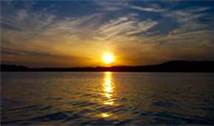
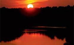
Fun times at Beaver Lake
|
| Average Temperatures | Jan | Feb | Mar | Apr | May | Jun | Jul | Aug | Sep | Oct | Nov | Dec |
|---|---|---|---|---|---|---|---|---|---|---|---|---|
| Avg. High 46 | Avg. High 51 | Avg. High 61 | Avg. High 70 | Avg. High 77 | Avg. High 83 | Avg. High 89 | Avg. High 89 | Avg. High 80 | Avg. High 70 | Avg. High 58 | Avg. High 47 | |
| Avg. Low 26 | Avg. Low 30 | Avg. Low 38 | Avg. Low 47 | Avg. Low 56 | Avg. Low 64 | Avg. Low 69 | Avg. Low 67 | Avg. Low 59 | Avg. Low 49 | Avg. Low 39 | Avg. Low 29 |