
- Boat Insurance
- Boat Browser
- Boating Courses
- Boat Registration
- Boating License
-
Boating Safety
Equipment
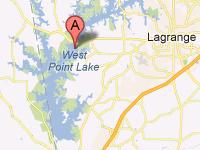
| West Point Lake The U.S. Army Corps of Engineers impounded the Chattahoochee River in 1975 with the West Point Dam, located near West Point, Georgia just north of Lake Harding, Goat Rock Lake, and Lake Oliver. The dam controls seasonal flooding and provides power to the region. This reservoir also is tasked to reserve water for release during dry periods to help maintain water levels in the navigable inland waterways that run from Columbus, Georgia, to the Gulf of Mexico -- the Chattahoochee River and the Apalachicola River. West Point Lake is the third most-visited reservoir for recreation in the basins of the Apalachicola, Chattahoochee, and Flint rivers, and one of Georgia's largest lakes. The 525 miles of shoreline along this lake provide facilities and parks that offer camping, sunning, swimming, and hunting. Although only a portion of this lake is located in Alabama, anyone visiting on that portion of the lake can enjoy state parks, water recreation, and fishing from Alabama's shorelines. Fishing Fishing licenses from Alabama and Georgia are valid, "with the exception of that portion of West Point Reservoir lying upstream (north) of Georgia Highway 109 Bridge on the Chattahoochee River arm of said reservoir." |
Search West Point Lake Resources |
 Coordinates:
| Boating The Corps of Engineers and other partners operate numerous access areas along this lake, and many parks also provide boat ramps. Bank fishing is popular at many locations, including the public fishing piers at Hardley Creek, Rocky Point, and McGee Bridge Parks. Navigation locks do not exist at this site. |
|
|
Lodging Almost the entire shoreline of West Point Lake in Alabama is lined with parks that contain camp sites and other recreation facilities. Lanett, located on the state line below the lake, also offers hotels. La Fayette, located just a few miles to the west of the lake, also provides lodging possibilities. Review the Lake Resource Guide for additional lodging. Communities The portion of West Point Lake in Alabama is located in Chambers County, and La Fayette and Lanett are the closest towns in that county. From Lanett, which sits on the Chattahoochee River below the lake, the trip to Montgomery is a little over an hour's drive. |
Fun times at West Point Lake
|


| Average Temperatures | Jan | Feb | Mar | Apr | May | Jun | Jul | Aug | Sep | Oct | Nov | Dec |
|---|---|---|---|---|---|---|---|---|---|---|---|---|
| Avg. High 54 | Avg. High 58 | Avg. High 66 | Avg. High 73 | Avg. High 80 | Avg. High 87 | Avg. High 89 | Avg. High 88 | Avg. High 83 | Avg. High 74 | Avg. High 65 | Avg. High 56 | |
| Avg. Low 32 | Avg. Low 35 | Avg. Low 42 | Avg. Low 48 | Avg. Low 58 | Avg. Low 66 | Avg. Low 70 | Avg. Low 69 | Avg. Low 63 | Avg. Low 51 | Avg. Low 42 | Avg. Low 35 |